| Item Detail |
| |
| |
MapMaker: |
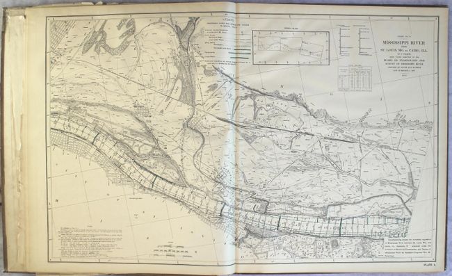
U.S. Government
|
|
| |
| |
Subject: |
Mississippi River, Missouri, Illinois |
|
| |
Period/Size: |
1909 / 36.8" x 22.8" (93.5 x 58.0 cm)
|
|
| |
Color: |
Colored
|
|
| |
Condition: |
(B+) Condition code is for the maps and other plates which are in very good to near fine condition with some light toning along sheet edges. The title page, list of plates, and front free endpaper have numerous old tape repaired tears and both the title (condition help) |
|
| |
Source: |
House Documents Vol. 2, 61st Cong., 1st Sess. |
|
| |
References: |
|
|
| |
|
|
| Sales Information |
| |
| |
Price: |
|
|
| |
| |
Offered by: |
Old World Auctions |
|
| |
Catalog: |
Auction No. 164 - Antique Maps, Charts, Atlases & Globes (9364) |
|
| |
Lot/Item #: |
201 |
|
| |
| |
Date: |
09/2017
|
|
| |
| |
|