| Item Detail |
| |
| |
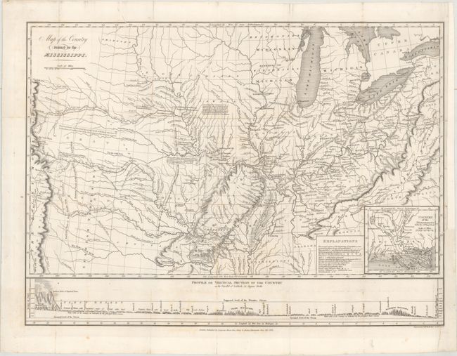
MapMaker: |
Stephen Harriman Long
|
|
| |
| |
Subject: |
Central United States |
|
| |
Period/Size: |
1823 / 14.8" x 20.2" (37.6 x 51.3 cm)
|
|
| |
Color: |
Black & White
|
|
| |
Condition: |
(B+) Issued folding and now flattened and professionally backed with tissue to reattached a thin, 4.5" section of mostly blank margin at lower right that had been torn to just inside the neatline. There is very faint scattered foxing mostly at bottom. (condition help) |
|
| |
Source: |
Account of an Expedition from Pittsburgh to the Rocky Mountains... |
|
| |
References: |
cf. Wheat (TMW ) #353; cf. Marcou & Marcou #23. |
|
| |
|
|
| Sales Information |
| |
| |
Price: |
|
|
| |
| |
Offered by: |
Old World Auctions |
|
| |
Catalog: |
Auction No. 164 - Antique Maps, Charts, Atlases & Globes (9364) |
|
| |
Lot/Item #: |
193 |
|
| |
| |
Date: |
09/2017
|
|
| |
| |
|