Title:
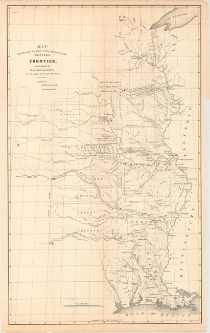
“Map Illustrating the Plan of the Defences of the Western Frontier, as Proposed by Maj. Gen. Gaines, in His Plan Dated Feby. 28th, 1838”
Map Maker:
David H. Burr
This map was issued as part of the continuing deba... (full text available to subscribers)
| Item Detail |
| |
| |
MapMaker: |
David H. Burr
|
|
| |
| |
Subject: |
Central United States |
|
| |
Period/Size: |
1838 / 23.6" x 14.4" (60.0 x 36.6 cm)
|
|
| |
Color: |
Black & White
|
|
| |
Condition: |
(B+) Issued folding with light toning and a few faint spots of foxing. (condition help) |
|
| |
Source: |
HR Doc. No. 311, 25th Congress, 2nd Session |
|
| |
References: |
Wheat (TMW) #432. |
|
| |
|
|
| Sales Information |
| |
| |
Price: |
|
|
| |
| |
Offered by: |
Old World Auctions |
|
| |
Catalog: |
Auction No. 164 - Antique Maps, Charts, Atlases & Globes (9364) |
|
| |
Lot/Item #: |
195 |
|
| |
| |
Date: |
09/2017
|
|
| |
| |
|
Antique Maps - Valuation and Pricing, Descriptions, Resources |
|
Home |
Information |
Search |
Register |
Contact Us |
Site Map
Americana Exchange, Inc. © 1999 - 2024 Americana Exchange, Inc.. All rights reserved.
OldMaps.com, the OldMaps.com logo and
AMPR are service marks or registered service marks of Americana Exchange, Inc..
|