Title:
“A Geographical Description of the State of Louisiana: Presenting a View of the Soil, Climate, Animal, Vegetable, and Mineral Productions...”
Map Maker:
William Darby
This 270 page volume was produced to accompany the... (full text available to subscribers)
| Item Detail |
| |
| |
MapMaker: |
William Darby
|
|
| |
| |
Subject: |
Books with maps, Louisiana |
|
| |
Period/Size: |
1816 / 7.9" x 4.8" (20.1 x 12.2 cm)
|
|
| |
Color: |
Black & White
|
|
| |
Condition: |
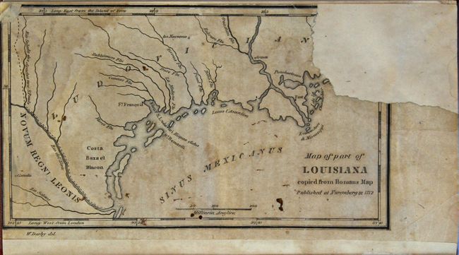
(B) The text is generally very good with light toning and scattered foxing mostly in the second half of the volume. The single-page map at the rear of the volume is chipped at top right, with an approximate 1.5 x 1.25" section of image that has been repl (condition help) |
|
| |
Source: |
|
|
| |
References: |
Howes #D62; Sabin #18528. |
|
| |
|
|
| Sales Information |
| |
| |
Price: |
|
|
| |
| |
Offered by: |
Old World Auctions |
|
| |
Catalog: |
Auction No. 164 - Antique Maps, Charts, Atlases & Globes (9364) |
|
| |
Lot/Item #: |
279 |
|
| |
| |
Date: |
09/2017
|
|
| |
| |
|
Antique Maps - Valuation and Pricing, Descriptions, Resources |
|
Home |
Information |
Search |
Register |
Contact Us |
Site Map
Americana Exchange, Inc. © 1999 - 2024 Americana Exchange, Inc.. All rights reserved.
OldMaps.com, the OldMaps.com logo and
AMPR are service marks or registered service marks of Americana Exchange, Inc..
|