| Item Detail |
| |
| |
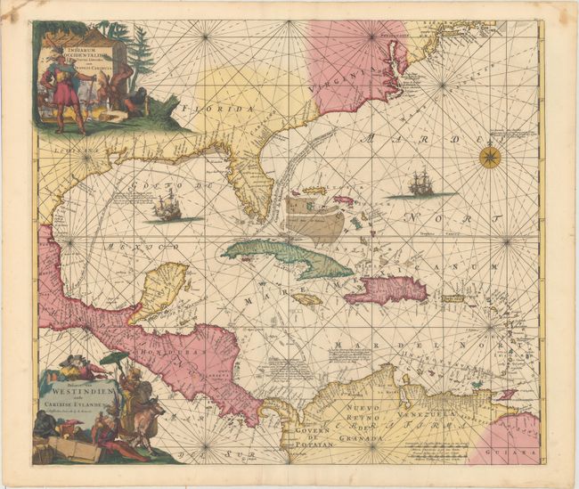
MapMaker: |
Renard/De Wit
|
|
| |
| |
Subject: |
Gulf of Mexico & Caribbean |
|
| |
Period/Size: |
1715 / 19.2" x 22.3" (48.8 x 56.7 cm)
|
|
| |
Color: |
Colored
|
|
| |
Condition: |
(A) A crisp impression in full original color on a clean, bright sheet with a couple of unobtrusive spots, a tiny hole by Cuba, an extraneous crease adjacent to the centerfold, and some marginal stains. (condition help) |
|
| |
Source: |
|
|
| |
References: |
Burden #468. |
|
| |
|
|
| Sales Information |
| |
| |
Price: |
|
|
| |
| |
Offered by: |
Old World Auctions |
|
| |
Catalog: |
Auction No. 164 - Antique Maps, Charts, Atlases & Globes (9364) |
|
| |
Lot/Item #: |
377 |
|
| |
| |
Date: |
09/2017
|
|
| |
| |
|