Title:
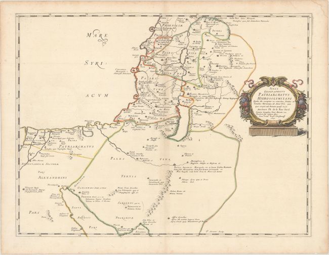
“Pinax Geographicus Patriarchatus Hierosolymitani Qualis Ille Excipitur ex Veteribus Notitiis et Conciiliis...”
Map Maker:
Philippe De La Rue
A sharply engraved map of the Holy Land extending ... (full text available to subscribers)
| Item Detail |
| |
| |
MapMaker: |
Philippe De La Rue
|
|
| |
| |
Subject: |
Holy Land |
|
| |
Period/Size: |
1651 / 15.9" x 20.9" (40.4 x 53.1 cm)
|
|
| |
Color: |
Colored
|
|
| |
Condition: |
(B+) Original outline color with later color in the cartouche on paper with a large coat of arms watermark and light toning along the centerfold and edges of the sheet. (condition help) |
|
| |
Source: |
La Terre Sainte en Six Cartes Geographiques |
|
| |
References: |
Laor #419; Pastoureau, LA RUE [5]. |
|
| |
|
|
| Sales Information |
| |
| |
Price: |
|
|
| |
| |
Offered by: |
Old World Auctions |
|
| |
Catalog: |
Auction No. 164 - Antique Maps, Charts, Atlases & Globes (9364) |
|
| |
Lot/Item #: |
652 |
|
| |
| |
Date: |
09/2017
|
|
| |
| |
|
Antique Maps - Valuation and Pricing, Descriptions, Resources |
|
Home |
Information |
Search |
Register |
Contact Us |
Site Map
Americana Exchange, Inc. © 1999 - 2024 Americana Exchange, Inc.. All rights reserved.
OldMaps.com, the OldMaps.com logo and
AMPR are service marks or registered service marks of Americana Exchange, Inc..
|