Title:
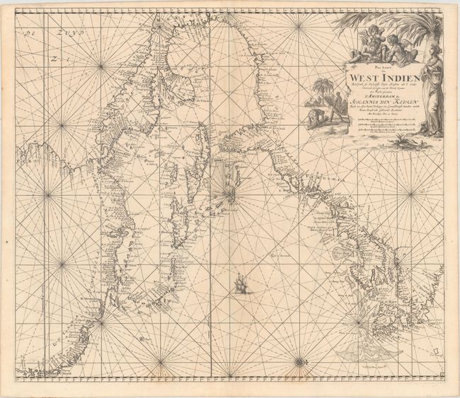
“Pas Kaart van West Indien Behelsende soo Deszelffs Vaste Kusten als d'Onder Behoorende Eylanden aan de Noord Oceaan...”
Map Maker:
Johannes van Keulen
This superb chart depicts the coastline of the wes... (full text available to subscribers)
| Item Detail |
| |
| |
MapMaker: |
Johannes van Keulen
|
|
| |
| |
Subject: |
Colonial Eastern North America & West Indies |
|
| |
Period/Size: |
1687 / 20.2" x 23.1" (51.3 x 58.7 cm)
|
|
| |
Color: |
Black & White
|
|
| |
Condition: |
(A) Excellent impression with a hint of toning along the centerfold and two faint stains along the bottom border. (condition help) |
|
| |
Source: |
De Nieuwe Groote Lichtende Zee-Fakkel |
|
| |
References: |
McCorkle #680.3. |
|
| |
|
|
| Sales Information |
| |
| |
Price: |
|
|
| |
| |
Offered by: |
Old World Auctions |
|
| |
Catalog: |
Auction No. 165 - Antique Maps, Charts, Atlases & Globes (9380) |
|
| |
Lot/Item #: |
77 |
|
| |
| |
Date: |
11/2017
|
|
| |
| |
|
Antique Maps - Valuation and Pricing, Descriptions, Resources |
|
Home |
Information |
Search |
Register |
Contact Us |
Site Map
Americana Exchange, Inc. © 1999 - 2024 Americana Exchange, Inc.. All rights reserved.
OldMaps.com, the OldMaps.com logo and
AMPR are service marks or registered service marks of Americana Exchange, Inc..
|