| Item Detail |
| |
| |
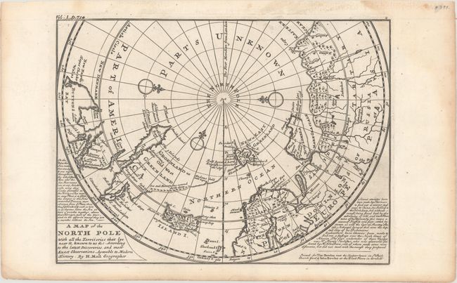
MapMaker: |
Herman Moll
|
|
| |
| |
Subject: |
North Pole |
|
| |
Period/Size: |
1744 / 8.0" x 10.9" (20.4 x 27.7 cm)
|
|
| |
Color: |
Black & White
|
|
| |
Condition: |
(A) A fine impression on a sheet with an "H" watermark, faint printer's ink residue at far right, and a printer's crease that just enters the neatline at right. There is light toning and soiling that is confined to the blank margins. (condition help) |
|
| |
Source: |
Modern History |
|
| |
References: |
Kershaw #410; Shirley (BL Atlases Vol 2) G.SALM-1c #19. |
|
| |
|
|
| Sales Information |
| |
| |
Price: |
|
|
| |
| |
Offered by: |
Old World Auctions |
|
| |
Catalog: |
Auction No. 165 - Antique Maps, Charts, Atlases & Globes (9380) |
|
| |
Lot/Item #: |
37 |
|
| |
| |
Date: |
11/2017
|
|
| |
| |
|