|
|
||
Title:
“Carte des Possessions Angloises dans l'Amerique Septentrionale pour Servir d'Intelligence a la Guerre Presente Traduite de l Angloise”
Map Maker:
J. Leopold Imbert
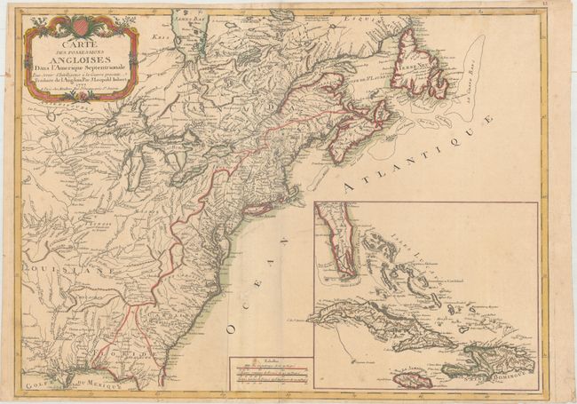
This is the first edition of Imbert's important
|
|
|||||||||||||||||||||||||||||||||||||||||||||||||||||||||||||||||||||||||||||||||||||||||
Antique Maps - Valuation and Pricing, Descriptions, Resources | ||||||||||||||||||||||||||||||||||||||||||||||||||||||||||||||||||||||||||||||||||||||||||
|
Home |
Information |
Search |
Register |
Contact Us |
Site Map
Americana Exchange, Inc. © 1999 - 2024 Americana Exchange, Inc.. All rights reserved.
OldMaps.com, the OldMaps.com logo and |