Title:
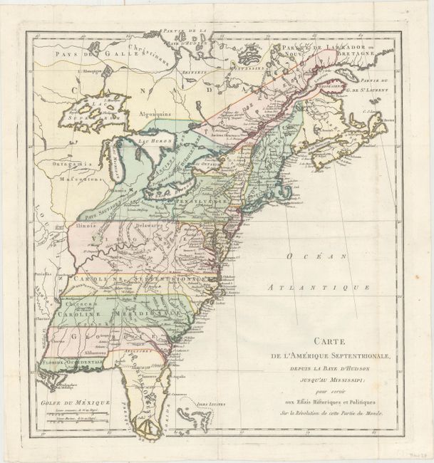
“Carte de l'Amerique Septentrionale, Depuis la Baye d'Hudson Jusqu'au Mississipi: pour Servir aux Essais Historiques et Politiques...”
Map Maker:
Michel-Rene Hilliard d'Auberteuil
This rare map was published in Michel Rene Hilliar... (full text available to subscribers)
| Item Detail |
| |
| |
MapMaker: |
Michel-Rene Hilliard d'Auberteuil
|
|
| |
| |
Subject: |
Colonial Eastern United States & Canada |
|
| |
Period/Size: |
1782 / 16.4" x 14.9" (41.7 x 37.9 cm)
|
|
| |
Color: |
Colored
|
|
| |
Condition: |
(A) Issued folding on watermarked paper with just a hint of soiling along the right fold. (condition help) |
|
| |
Source: |
Essais Historiques et Politiques sur les Anglo-Americans |
|
| |
References: |
Howes #H493. |
|
| |
|
|
| Sales Information |
| |
| |
Price: |
|
|
| |
| |
Offered by: |
Old World Auctions |
|
| |
Catalog: |
Auction No. 165 - Antique Maps, Charts, Atlases & Globes (9380) |
|
| |
Lot/Item #: |
88 |
|
| |
| |
Date: |
11/2017
|
|
| |
| |
|
Antique Maps - Valuation and Pricing, Descriptions, Resources |
|
Home |
Information |
Search |
Register |
Contact Us |
Site Map
Americana Exchange, Inc. © 1999 - 2024 Americana Exchange, Inc.. All rights reserved.
OldMaps.com, the OldMaps.com logo and
AMPR are service marks or registered service marks of Americana Exchange, Inc..
|