| Item Detail |
| |
| |
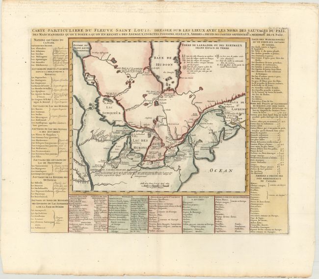
MapMaker: |
Henry Abraham Chatelain
|
|
| |
| |
Subject: |
Colonial Northeastern United States & Canada, Great Lakes |
|
| |
Period/Size: |
1720 / 14.4" x 18.0" (36.6 x 45.8 cm)
|
|
| |
Color: |
Colored
|
|
| |
Condition: |
(A) A sharp impression on a clean, bright sheet with a Strasburg Lily and "IV" watermarks and light toning along the edges of the sheet. (condition help) |
|
| |
Source: |
Atlas Historique |
|
| |
References: |
Kershaw #307. |
|
| |
|
|
| Sales Information |
| |
| |
Price: |
|
|
| |
| |
Offered by: |
Old World Auctions |
|
| |
Catalog: |
Auction No. 165 - Antique Maps, Charts, Atlases & Globes (9380) |
|
| |
Lot/Item #: |
94 |
|
| |
| |
Date: |
11/2017
|
|
| |
| |
|