| Item Detail |
| |
| |
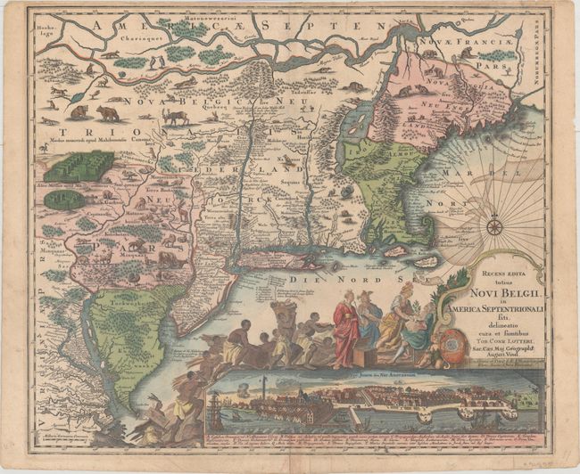
MapMaker: |
Seutter/Lotter
|
|
| |
| |
Subject: |
Colonial New England & Mid-Atlantic United States |
|
| |
Period/Size: |
1757 / 19.7" x 23.0" (50.1 x 58.5 cm)
|
|
| |
Color: |
Colored
|
|
| |
Condition: |
(B+) A nice impression with light soiling and old paper repairs on verso to a 1" centerfold separation at top, a 2" centerfold separation at bottom, three edge tears that just enter the map border, and a tear that enters 1" into image at top. (condition help) |
|
| |
Source: |
|
|
| |
References: |
McCorkle #730.5; Tooley (Amer) p. 292, #26a, plt. 160-162. |
|
| |
|
|
| Sales Information |
| |
| |
Price: |
|
|
| |
| |
Offered by: |
Old World Auctions |
|
| |
Catalog: |
Auction No. 165 - Antique Maps, Charts, Atlases & Globes (9380) |
|
| |
Lot/Item #: |
131 |
|
| |
| |
Date: |
11/2017
|
|
| |
| |
|