Title:
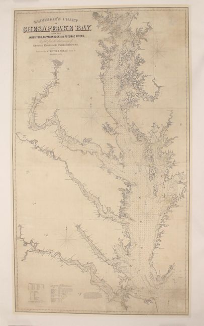
“Eldridge's Chart of Chesapeake Bay, with the James, York, Rappahannock and Potomac Rivers”
Map Maker:
George Eldridge
This is the 1874 state of this important chart, fi... (full text available to subscribers)
| Item Detail |
| |
| |
MapMaker: |
George Eldridge
|
|
| |
| |
Subject: |
Mid-Atlantic United States |
|
| |
Period/Size: |
1874 / 56.4" x 32.3" (143.3 x 82.1 cm)
|
|
| |
Color: |
Black & White
|
|
| |
Condition: |
(B) A dark impression on a sheet that has been professionally backed with heavy linen to reinforce and repair several small tears at top and bottom, as well as one small tear adjacent to the title. There are a few abrasions at top, some cracking in the m (condition help) |
|
| |
Source: |
|
|
| |
References: |
|
|
| |
|
|
| Sales Information |
| |
| |
Price: |
|
|
| |
| |
Offered by: |
Old World Auctions |
|
| |
Catalog: |
Auction No. 165 - Antique Maps, Charts, Atlases & Globes (9380) |
|
| |
Lot/Item #: |
142 |
|
| |
| |
Date: |
11/2017
|
|
| |
| |
|
Antique Maps - Valuation and Pricing, Descriptions, Resources |
|
Home |
Information |
Search |
Register |
Contact Us |
Site Map
Americana Exchange, Inc. © 1999 - 2024 Americana Exchange, Inc.. All rights reserved.
OldMaps.com, the OldMaps.com logo and
AMPR are service marks or registered service marks of Americana Exchange, Inc..
|