| Item Detail |
| |
| |
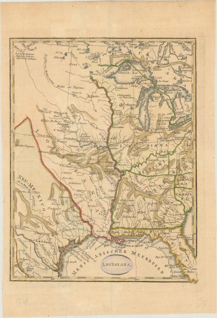
MapMaker: |
Theodor Friedrich Ehrmann
|
|
| |
| |
Subject: |
Central United States |
|
| |
Period/Size: |
1804 / 8.5" x 6.6" (21.6 x 16.8 cm)
|
|
| |
Color: |
Colored
|
|
| |
Condition: |
(B+) Issued folding on watermarked paper with light toning. There is an edge tear at right that just touches the border that has been closed on verso with archival material. (condition help) |
|
| |
Source: |
Schilderung von Louisiana... |
|
| |
References: |
Phillips (Maps) p. 371; Sabin #4964. |
|
| |
|
|
| Sales Information |
| |
| |
Price: |
|
|
| |
| |
Offered by: |
Old World Auctions |
|
| |
Catalog: |
Auction No. 165 - Antique Maps, Charts, Atlases & Globes (9380) |
|
| |
Lot/Item #: |
165 |
|
| |
| |
Date: |
11/2017
|
|
| |
| |
|