| Item Detail |
| |
| |
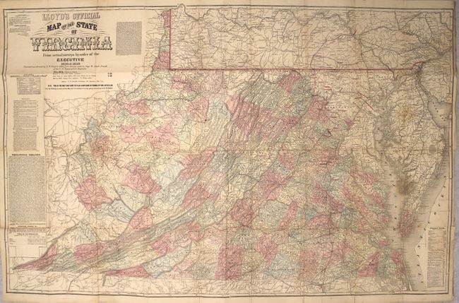
MapMaker: |
James T. Lloyd
|
|
| |
| |
Subject: |
Virginia |
|
| |
Period/Size: |
1862 / 30.3" x 47.1" (77.0 x 119.7 cm)
|
|
| |
Color: |
Colored
|
|
| |
Condition: |
(B+) There are a number of short separations along the folds, as well as one 5" separation at far right. There is light soiling and numerous old manuscript markings in orange, red, and blue highlighting cities, roads, and rivers. (condition help) |
|
| |
Source: |
|
|
| |
References: |
Wooldridge, pp. 257-61; cf. Stephenson #465. |
|
| |
|
|
| Sales Information |
| |
| |
Price: |
|
|
| |
| |
Offered by: |
Old World Auctions |
|
| |
Catalog: |
Auction No. 165 - Antique Maps, Charts, Atlases & Globes (9380) |
|
| |
Lot/Item #: |
309 |
|
| |
| |
Date: |
11/2017
|
|
| |
| |
|