Title:
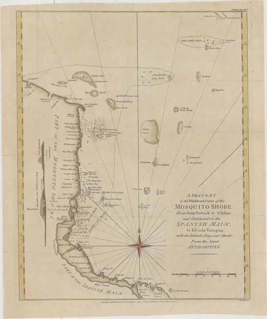
“A Draught of the Windward Coast of the Mosquito Shore from Point Pattuck to St. Johns and Continued on the Spanish Main, to Escuda Veragua, with the Islands, Keys, and Shoals, from the Latest Authorities”
Map Maker:
John Lodge
This map details the Gulf Coast of Costa Rica and ... (full text available to subscribers)
| Item Detail |
| |
| |
MapMaker: |
John Lodge
|
|
| |
| |
Subject: |
Nicaragua & Costa Rica |
|
| |
Period/Size: |
1785 / 14.2" x 11.4" (36.1 x 29.0 cm)
|
|
| |
Color: |
Colored
|
|
| |
Condition: |
(A) Issued folding, now flattened, on paper with "Pro Patria" and "T French" watermarks. There is a tiny hole above the title and a couple of minor mis-folds. (condition help) |
|
| |
Source: |
Political Magazine |
|
| |
References: |
Jolly #POL-92; Kapp (MCC-106) #74. |
|
| |
|
|
| Sales Information |
| |
| |
Price: |
|
|
| |
| |
Offered by: |
Old World Auctions |
|
| |
Catalog: |
Auction No. 165 - Antique Maps, Charts, Atlases & Globes (9380) |
|
| |
Lot/Item #: |
330 |
|
| |
| |
Date: |
11/2017
|
|
| |
| |
|
Antique Maps - Valuation and Pricing, Descriptions, Resources |
|
Home |
Information |
Search |
Register |
Contact Us |
Site Map
Americana Exchange, Inc. © 1999 - 2024 Americana Exchange, Inc.. All rights reserved.
OldMaps.com, the OldMaps.com logo and
AMPR are service marks or registered service marks of Americana Exchange, Inc..
|