Title:
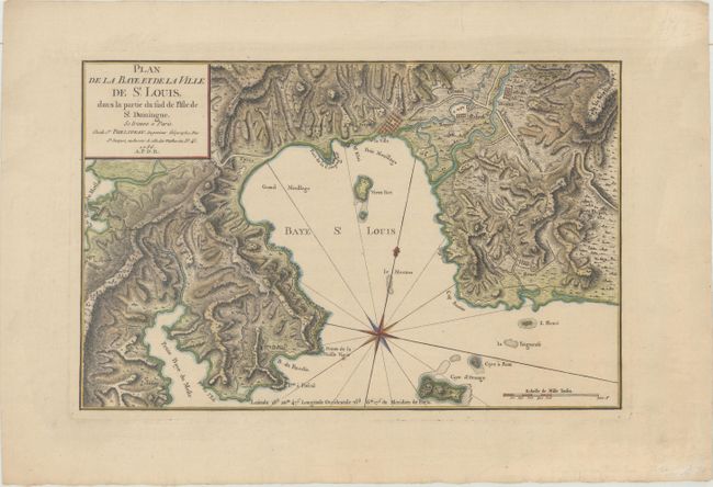
“Plan de la Baye et de la Ville de St. Louis, dans la Partie du Sud de l'Isle de St. Domingue...”
Map Maker:
Rene Phelipeau
This scarce map is centered on Saint Louis Bay loc... (full text available to subscribers)
| Item Detail |
| |
| |
MapMaker: |
Rene Phelipeau
|
|
| |
| |
Subject: |
Saint-Louis-du-Sud, Haiti |
|
| |
Period/Size: |
1786 / 9.6" x 14.8" (24.4 x 37.6 cm)
|
|
| |
Color: |
Colored
|
|
| |
Condition: |
(A) A sharp impression on watermarked paper with light marginal soiling. (condition help) |
|
| |
Source: |
|
|
| |
References: |
|
|
| |
|
|
| Sales Information |
| |
| |
Price: |
|
|
| |
| |
Offered by: |
Old World Auctions |
|
| |
Catalog: |
Auction No. 165 - Antique Maps, Charts, Atlases & Globes (9380) |
|
| |
Lot/Item #: |
359 |
|
| |
| |
Date: |
11/2017
|
|
| |
| |
|
Antique Maps - Valuation and Pricing, Descriptions, Resources |
|
Home |
Information |
Search |
Register |
Contact Us |
Site Map
Americana Exchange, Inc. © 1999 - 2024 Americana Exchange, Inc.. All rights reserved.
OldMaps.com, the OldMaps.com logo and
AMPR are service marks or registered service marks of Americana Exchange, Inc..
|