| Item Detail |
| |
| |
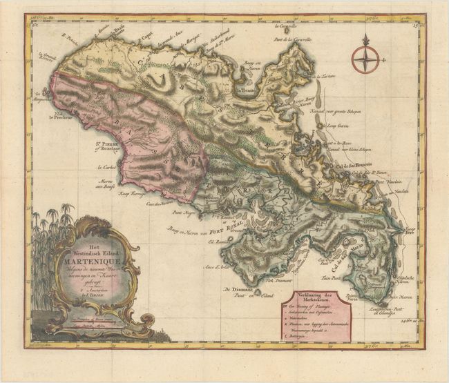
MapMaker: |
Isaac Tirion
|
|
| |
| |
Subject: |
Martinique |
|
| |
Period/Size: |
1769 / 12.1" x 14.4" (30.8 x 36.6 cm)
|
|
| |
Color: |
Colored
|
|
| |
Condition: |
(A) A crisp impression on a clean, bright sheet. Issued folding with a minor misfold at right and a binding trim at right that has been replaced with period-correct paper. (condition help) |
|
| |
Source: |
Hedendaagsche Historie, of Tegenwoordigestaat van Amerika |
|
| |
References: |
Shirley (BL Atlases) G.TIR-1a #20. |
|
| |
|
|
| Sales Information |
| |
| |
Price: |
|
|
| |
| |
Offered by: |
Old World Auctions |
|
| |
Catalog: |
Auction No. 165 - Antique Maps, Charts, Atlases & Globes (9380) |
|
| |
Lot/Item #: |
365 |
|
| |
| |
Date: |
11/2017
|
|
| |
| |
|