| Item Detail |
| |
| |
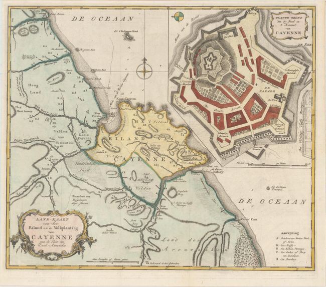
MapMaker: |
Isaac Tirion
|
|
| |
| |
Subject: |
French Guiana |
|
| |
Period/Size: |
1769 / 14.2" x 16.6" (36.1 x 42.2 cm)
|
|
| |
Color: |
Colored
|
|
| |
Condition: |
(A+) A clean and bright example, issued folding, now flattened, with a binding trim at right that has been replaced with period-correct paper. (condition help) |
|
| |
Source: |
Nieuwe en Beknopte Hand-Atlas |
|
| |
References: |
Shirley (BL Atlases) T.TIR-2a. |
|
| |
|
|
| Sales Information |
| |
| |
Price: |
|
|
| |
| |
Offered by: |
Old World Auctions |
|
| |
Catalog: |
Auction No. 165 - Antique Maps, Charts, Atlases & Globes (9380) |
|
| |
Lot/Item #: |
384 |
|
| |
| |
Date: |
11/2017
|
|
| |
| |
|