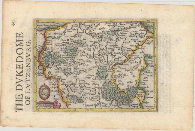
Title:
“Trier et Lutzeborg”
Map Maker:
Mercator/Hondius
This handsome small map is roughly centered on the... (full text available to subscribers)
| Item Detail |
| |
| |
MapMaker: |
Mercator/Hondius
|
|
| |
| |
Subject: |
Luxembourg & Western Germany |
|
| |
Period/Size: |
1635 / 5.4" x 7.2" (13.8 x 18.3 cm)
|
|
| |
Color: |
Colored
|
|
| |
Condition: |
(A) A sharp impression on watermarked paper with several minor extraneous creases and light toning along the edges of the sheet. (condition help) |
|
| |
Source: |
Historia Mundi or Mercators Atlas... |
|
| |
References: |
Van der Krogt (Vol. III) #2430:351. |
|
| |
|
|
| Sales Information |
| |
| |
Price: |
|
|
| |
| |
Offered by: |
Old World Auctions |
|
| |
Catalog: |
Auction No. 165 - Antique Maps, Charts, Atlases & Globes (9380) |
|
| |
Lot/Item #: |
469 |
|
| |
| |
Date: |
11/2017
|
|
| |
| |
|
Antique Maps - Valuation and Pricing, Descriptions, Resources |
|
Home |
Information |
Search |
Register |
Contact Us |
Site Map
Americana Exchange, Inc. © 1999 - 2024 Americana Exchange, Inc.. All rights reserved.
OldMaps.com, the OldMaps.com logo and
AMPR are service marks or registered service marks of Americana Exchange, Inc..
|