Title:
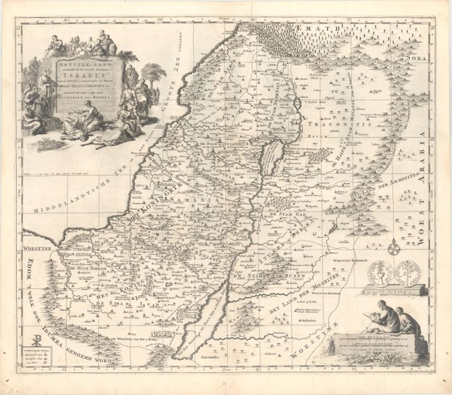
“Het Heylige Land Verdeeld in de Twaalf Stammen Israels...”
Map Maker:
Pierre Mortier
This decorative map of present-day Israel, Lebanon... (full text available to subscribers)
| Item Detail |
| |
| |
MapMaker: |
Pierre Mortier
|
|
| |
| |
Subject: |
Holy Land |
|
| |
Period/Size: |
1700 / 15.7" x 18.5" (39.9 x 47.0 cm)
|
|
| |
Color: |
Black & White
|
|
| |
Condition: |
(A) A crisp impression on watermarked paper with minor offsetting and a short centerfold separation in the bottom blank margin that has been closed with archival tape. (condition help) |
|
| |
Source: |
Historie des Ouden en Nieuwen Testaments |
|
| |
References: |
Laor #508. |
|
| |
|
|
| Sales Information |
| |
| |
Price: |
|
|
| |
| |
Offered by: |
Old World Auctions |
|
| |
Catalog: |
Auction No. 165 - Antique Maps, Charts, Atlases & Globes (9380) |
|
| |
Lot/Item #: |
633 |
|
| |
| |
Date: |
11/2017
|
|
| |
| |
|
Antique Maps - Valuation and Pricing, Descriptions, Resources |
|
Home |
Information |
Search |
Register |
Contact Us |
Site Map
Americana Exchange, Inc. © 1999 - 2024 Americana Exchange, Inc.. All rights reserved.
OldMaps.com, the OldMaps.com logo and
AMPR are service marks or registered service marks of Americana Exchange, Inc..
|