Title:
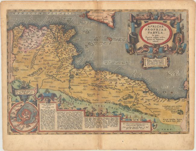
“Africae Propriae Tabula, in qua, Punica Regna Vides; Tyrios, et Agenoris Urbem”
Map Maker:
Abraham Ortelius
Very decorative map of the coastline covering pres... (full text available to subscribers)
| Item Detail |
| |
| |
MapMaker: |
Abraham Ortelius
|
|
| |
| |
Subject: |
Northern Africa |
|
| |
Period/Size: |
1590 / 13.2" x 19.3" (33.6 x 49.1 cm)
|
|
| |
Color: |
Colored
|
|
| |
Condition: |
(B) A nice impression on paper with the common crossed arrows watermark found on Ortelius' maps. There is moderate toning along the centerfold, light soiling, and professional repairs to several separations and small holes along the centerfold, with a ti (condition help) |
|
| |
Source: |
Theatrum Orbis Terrarum |
|
| |
References: |
Van den Broecke #218. |
|
| |
|
|
| Sales Information |
| |
| |
Price: |
|
|
| |
| |
Offered by: |
Old World Auctions |
|
| |
Catalog: |
Auction No. 165 - Antique Maps, Charts, Atlases & Globes (9380) |
|
| |
Lot/Item #: |
706 |
|
| |
| |
Date: |
11/2017
|
|
| |
| |
|
Antique Maps - Valuation and Pricing, Descriptions, Resources |
|
Home |
Information |
Search |
Register |
Contact Us |
Site Map
Americana Exchange, Inc. © 1999 - 2024 Americana Exchange, Inc.. All rights reserved.
OldMaps.com, the OldMaps.com logo and
AMPR are service marks or registered service marks of Americana Exchange, Inc..
|