| Item Detail |
| |
| |
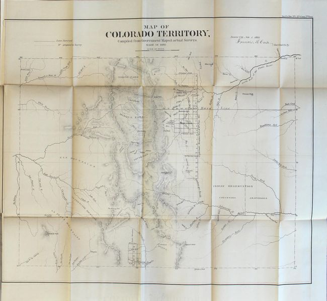
MapMaker: |
General Land Office
|
|
| |
| |
Subject: |
Atlases, Western United States |
|
| |
Period/Size: |
1861 / 9.1" x 5.9" (23.2 x 15.0 cm)
|
|
| |
Color: |
Black & White
|
|
| |
Condition: |
(B) The maps have light toning along the folds, occasional minor splits at fold intersections, and a few short binding tears that just enter the images. The map of Colorado is trimmed to just inside the neatline at left as issued, and the maps of New Mex (condition help) |
|
| |
Source: |
Sen. Ex. Doc. 1, 37th Congress, 2nd Session |
|
| |
References: |
|
|
| |
|
|
| Sales Information |
| |
| |
Price: |
|
|
| |
| |
Offered by: |
Old World Auctions |
|
| |
Catalog: |
Auction No. 165 - Antique Maps, Charts, Atlases & Globes (9380) |
|
| |
Lot/Item #: |
780 |
|
| |
| |
Date: |
11/2017
|
|
| |
| |
|