Title:
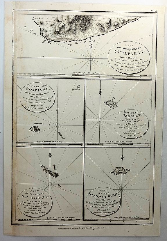
“Part of the Island of Quelpaert, Hoapinsu, Dagelet, Botol & Kumi”
Map Maker:
Jean Francois Galaup de La Perouse
A fine copper engraved chart with inserts of the I... (full text available to subscribers)
| Item Detail |
| |
| |
MapMaker: |
Jean Francois Galaup de La Perouse
|
|
| |
| |
Subject: |
Korea |
|
| |
Period/Size: |
1798 / 14.6" x 9.6" (37.1 x 24.4 cm)
|
|
| |
Color: |
Black & White
|
|
| |
Condition: |
In good condition with left side re-margined. (condition help) |
|
| |
Source: |
ATLAS DU VOYAGE DE LA PEROUSE |
|
| |
References: |
|
|
| |
|
|
| Sales Information |
| |
| |
Price: |
|
|
| |
| |
Offered by: |
Paulus Swaen Old Maps & Prints |
|
| |
Catalog: |
June 26,2018 - Internet Auction (9392) |
|
| |
Lot/Item #: |
81223 |
|
| |
| |
Date: |
06/2018
|
|
| |
| |
|
Antique Maps - Valuation and Pricing, Descriptions, Resources |
|
Home |
Information |
Search |
Register |
Contact Us |
Site Map
Americana Exchange, Inc. © 1999 - 2024 Americana Exchange, Inc.. All rights reserved.
OldMaps.com, the OldMaps.com logo and
AMPR are service marks or registered service marks of Americana Exchange, Inc..
|