| Item Detail |
| |
| |
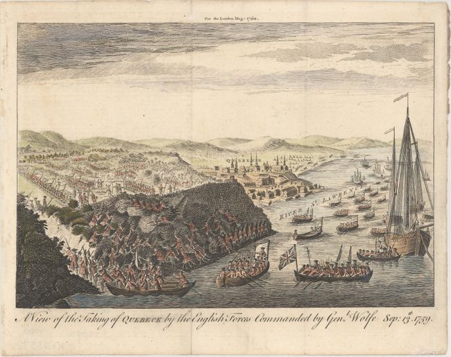
MapMaker: |
Anonymous
|
|
| |
| |
Subject: |
Quebec City, Canada |
|
| |
Period/Size: |
1760 / 6.7" x 9.8" (17.1 x 24.9 cm)
|
|
| |
Color: |
Colored
|
|
| |
Condition: |
(A) Issued folding with a short fold separation in the bottom blank margin that has been closed on verso with archival tape. There is minor soiling and toning along the edges of the sheet. (condition help) |
|
| |
Source: |
London Magazine |
|
| |
References: |
|
|
| |
|
|
| Sales Information |
| |
| |
Price: |
|
|
| |
| |
Offered by: |
Old World Auctions |
|
| |
Catalog: |
Auction No. 166 - Antique Maps, Charts, Atlases & Globes (9434) |
|
| |
Lot/Item #: |
99 |
|
| |
| |
Date: |
02/2018
|
|
| |
| |
|