| Item Detail |
| |
| |
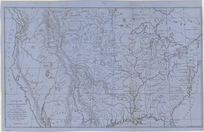
MapMaker: |
George Catlin
|
|
| |
| |
Subject: |
United States & Canada |
|
| |
Period/Size: |
1892 / 8.8" x 14.4" (22.4 x 36.6 cm)
|
|
| |
Color: |
Black & White
|
|
| |
Condition: |
(B) Printed on bluish paper and issued folding. There are separations along the right fold that have been closed on verso with both archival tape and cello tape, with minor tape stains visible on recto at the top and bottom of the fold. There are a few (condition help) |
|
| |
Source: |
Indian Gallery |
|
| |
References: |
|
|
| |
|
|
| Sales Information |
| |
| |
Price: |
|
|
| |
| |
Offered by: |
Old World Auctions |
|
| |
Catalog: |
Auction No. 166 - Antique Maps, Charts, Atlases & Globes (9434) |
|
| |
Lot/Item #: |
101 |
|
| |
| |
Date: |
02/2018
|
|
| |
| |
|