| Item Detail |
| |
| |
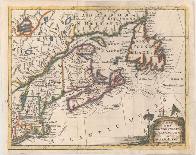
MapMaker: |
Anonymous
|
|
| |
| |
Subject: |
Colonial New England & Canada |
|
| |
Period/Size: |
1755 / 8.2" x 10.5" (20.9 x 26.7 cm)
|
|
| |
Color: |
Colored
|
|
| |
Condition: |
(B+) Issued folding, now flattened with light soiling, a few minor extraneous creases, and a binding trim at left that has been professionally replaced with period-correct paper. (condition help) |
|
| |
Source: |
London Magazine |
|
| |
References: |
Jolly #LOND-96; Kershaw #351; McCorkle #755-28; Sellers & Van Ee #65. |
|
| |
|
|
| Sales Information |
| |
| |
Price: |
|
|
| |
| |
Offered by: |
Old World Auctions |
|
| |
Catalog: |
Auction No. 166 - Antique Maps, Charts, Atlases & Globes (9434) |
|
| |
Lot/Item #: |
111 |
|
| |
| |
Date: |
02/2018
|
|
| |
| |
|