| Item Detail |
| |
| |
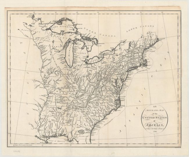
MapMaker: |
John Russell
|
|
| |
| |
Subject: |
Eastern United States |
|
| |
Period/Size: |
1794 / 14.5" x 18.4" (36.9 x 46.8 cm)
|
|
| |
Color: |
Black & White
|
|
| |
Condition: |
(B) On a bright sheet that is issued folding and now flattened and backed with heavy tissue to reinforce and repair a long separation along the left fold and a 3.5" binding tear at right. Trimmed to the neatline at bottom and right with several minor fol (condition help) |
|
| |
Source: |
An Historical, Geographical, Commercial, and Philosophical View of the American |
|
| |
References: |
McCorkle #794.14; Phillips (A) #1363-4. |
|
| |
|
|
| Sales Information |
| |
| |
Price: |
|
|
| |
| |
Offered by: |
Old World Auctions |
|
| |
Catalog: |
Auction No. 166 - Antique Maps, Charts, Atlases & Globes (9434) |
|
| |
Lot/Item #: |
125 |
|
| |
| |
Date: |
02/2018
|
|
| |
| |
|