Title:
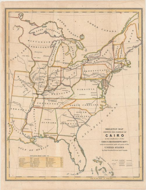
“Skeleton Map Shewing the Position of Cairo at the Confluence of the Ohio & Mississippi Rivs. and Its Connection with All Parts of the United States by Rail Roads Rivers and Canals”
Map Maker:
U.S. Government
This unusual map is focused on the transportation ... (full text available to subscribers)
| Item Detail |
| |
| |
MapMaker: |
U.S. Government
|
|
| |
| |
Subject: |
Eastern United States |
|
| |
Period/Size: |
1836 / 14.6" x 11.8" (37.1 x 30.0 cm)
|
|
| |
Color: |
Colored
|
|
| |
Condition: |
(B+) Issued folding with a couple of minor spots of foxing, some minute worm holes only visible when held to light, and faint damp stains along the edges of the sheet. (condition help) |
|
| |
Source: |
|
|
| |
References: |
|
|
| |
|
|
| Sales Information |
| |
| |
Price: |
|
|
| |
| |
Offered by: |
Old World Auctions |
|
| |
Catalog: |
Auction No. 166 - Antique Maps, Charts, Atlases & Globes (9434) |
|
| |
Lot/Item #: |
129 |
|
| |
| |
Date: |
02/2018
|
|
| |
| |
|
Antique Maps - Valuation and Pricing, Descriptions, Resources |
|
Home |
Information |
Search |
Register |
Contact Us |
Site Map
Americana Exchange, Inc. © 1999 - 2024 Americana Exchange, Inc.. All rights reserved.
OldMaps.com, the OldMaps.com logo and
AMPR are service marks or registered service marks of Americana Exchange, Inc..
|