| Item Detail |
| |
| |
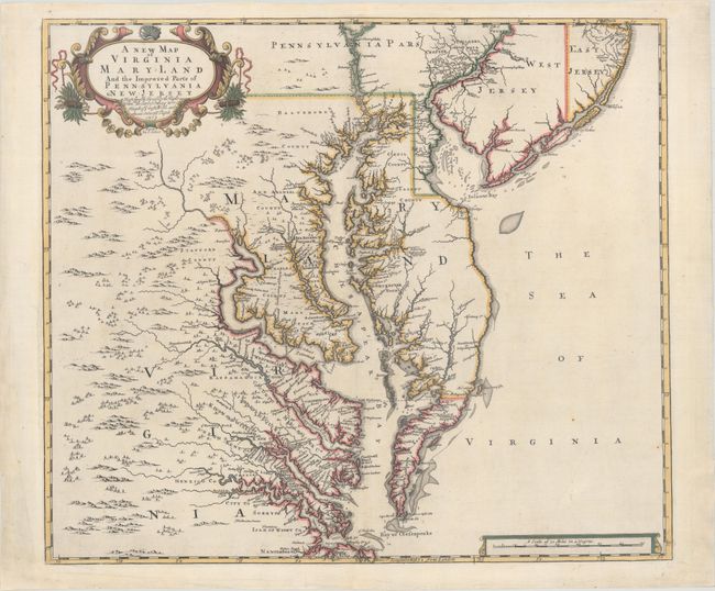
MapMaker: |
Browne/Senex
|
|
| |
| |
Subject: |
Colonial Mid-Atlantic United States |
|
| |
Period/Size: |
1719 / 19.1" x 21.9" (48.6 x 55.7 cm)
|
|
| |
Color: |
Colored
|
|
| |
Condition: |
(A) A sharp impression on a clean bright sheet of paper with watermarks of a fleur-de-lis and the initials "AB." There are professional repairs to centerfold separations that enter about 1" into image at top and bottom, as well as to a few small chips an (condition help) |
|
| |
Source: |
New General Atlas |
|
| |
References: |
Burden #694; Stephenson & McKee, p. 52, #II-17; Stevens & Tree #86c; Wooldridge #84. |
|
| |
|
|
| Sales Information |
| |
| |
Price: |
|
|
| |
| |
Offered by: |
Old World Auctions |
|
| |
Catalog: |
Auction No. 166 - Antique Maps, Charts, Atlases & Globes (9434) |
|
| |
Lot/Item #: |
144 |
|
| |
| |
Date: |
02/2018
|
|
| |
| |
|