| Item Detail |
| |
| |
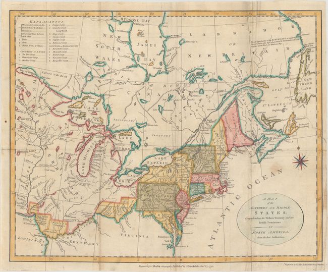
MapMaker: |
John Stockdale
|
|
| |
| |
Subject: |
Eastern United States & Canada |
|
| |
Period/Size: |
1792 / 12.3" x 15.2" (31.3 x 38.6 cm)
|
|
| |
Color: |
Colored
|
|
| |
Condition: |
(B) Issued folding, now flat, with light soiling and a tiny chip in the title cartouche that has been repaired with archival materials, with the "N" in North America replaced in facsimile. There are several fold separations and a 2" edge tear at right th (condition help) |
|
| |
Source: |
Morse's Geography |
|
| |
References: |
McCorkle #792.1; Kershaw #389. |
|
| |
|
|
| Sales Information |
| |
| |
Price: |
|
|
| |
| |
Offered by: |
Old World Auctions |
|
| |
Catalog: |
Auction No. 166 - Antique Maps, Charts, Atlases & Globes (9434) |
|
| |
Lot/Item #: |
106 |
|
| |
| |
Date: |
02/2018
|
|
| |
| |
|