Title:
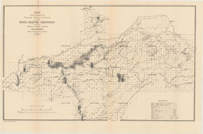
“Map Showing the Location of the Principal Mining Companies on the Blue Gravel Channels Situation in Sierra & Nevada Counties California”
Map Maker:
U.S. Government
This scarce map shows mining claims in the vicinit... (full text available to subscribers)
| Item Detail |
| |
| |
MapMaker: |
U.S. Government
|
|
| |
| |
Subject: |
Central California, Mining |
|
| |
Period/Size: |
1880 / 15.7" x 26.2" (39.9 x 66.6 cm)
|
|
| |
Color: |
Black & White
|
|
| |
Condition: |
(B+) Issued folding with light toning along the top left fold and a minor tape repair confined to the top blank margin. (condition help) |
|
| |
Source: |
House Ex. Doc. No 46 |
|
| |
References: |
|
|
| |
|
|
| Sales Information |
| |
| |
Price: |
|
|
| |
| |
Offered by: |
Old World Auctions |
|
| |
Catalog: |
Auction No. 166 - Antique Maps, Charts, Atlases & Globes (9434) |
|
| |
Lot/Item #: |
202 |
|
| |
| |
Date: |
02/2018
|
|
| |
| |
|
Antique Maps - Valuation and Pricing, Descriptions, Resources |
|
Home |
Information |
Search |
Register |
Contact Us |
Site Map
Americana Exchange, Inc. © 1999 - 2024 Americana Exchange, Inc.. All rights reserved.
OldMaps.com, the OldMaps.com logo and
AMPR are service marks or registered service marks of Americana Exchange, Inc..
|