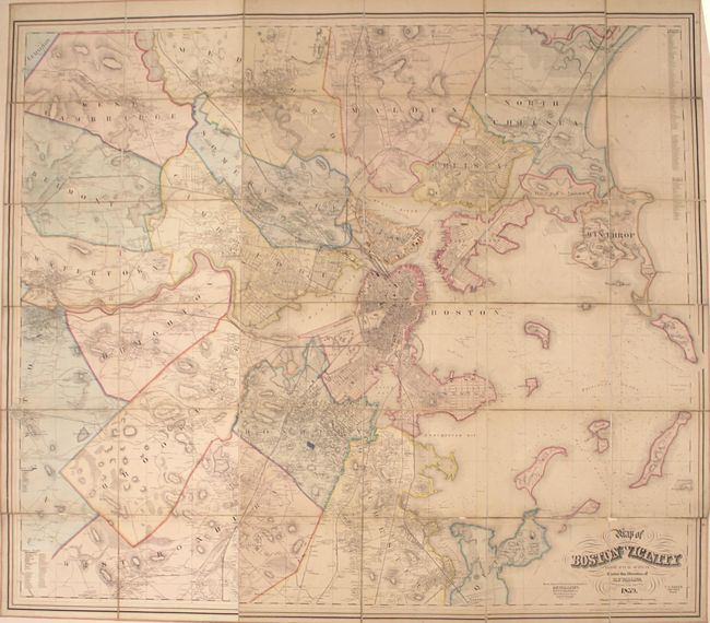
Title:
“Map of Boston and Its Vicinity from Actual Surveys...”
Map Maker:
Henry Francis Walling
This very large, detailed, folding map covers the ... (full text available to subscribers)
| Item Detail |
| |
| |
MapMaker: |
Henry Francis Walling
|
|
| |
| |
Subject: |
Boston, Massachusetts |
|
| |
Period/Size: |
1859 / 55.7" x 63.9" (141.5 x 162.3 cm)
|
|
| |
Color: |
Colored
|
|
| |
Condition: |
(B) Issued folding with numerous splits of the linen primarily along the top and bottom horizontal fold with some small loss of image along the bottom fold. Pleasant light toning with a a bit of manuscript color added at the center of the image (Roxbury) (condition help) |
|
| |
Source: |
|
|
| |
References: |
|
|
| |
|
|
| Sales Information |
| |
| |
Price: |
|
|
| |
| |
Offered by: |
Old World Auctions |
|
| |
Catalog: |
Auction No. 166 - Antique Maps, Charts, Atlases & Globes (9434) |
|
| |
Lot/Item #: |
251 |
|
| |
| |
Date: |
02/2018
|
|
| |
| |
|
Antique Maps - Valuation and Pricing, Descriptions, Resources |
|
Home |
Information |
Search |
Register |
Contact Us |
Site Map
Americana Exchange, Inc. © 1999 - 2024 Americana Exchange, Inc.. All rights reserved.
OldMaps.com, the OldMaps.com logo and
AMPR are service marks or registered service marks of Americana Exchange, Inc..
|