| Item Detail |
| |
| |
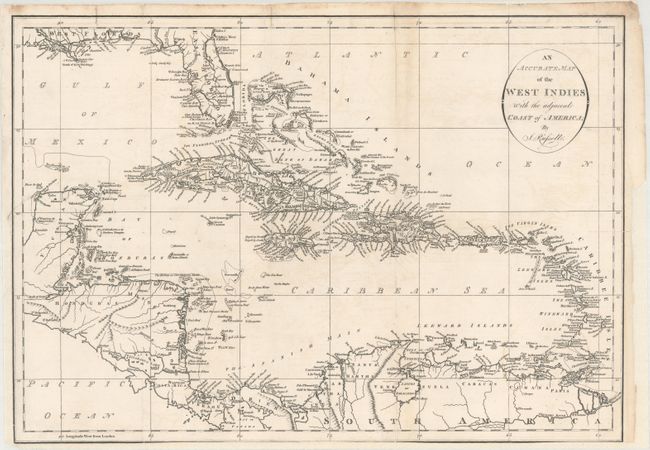
MapMaker: |
John Russell
|
|
| |
| |
Subject: |
Caribbean |
|
| |
Period/Size: |
1794 / 13.8" x 19.6" (35.1 x 49.8 cm)
|
|
| |
Color: |
Black & White
|
|
| |
Condition: |
(B) On a bright sheet that is issued folding and now flattened and backed with heavy tissue to repair several fold separations mostly along the right fold and three small edge tears. There is a binding trim at lower left and the bottom of the sheet has b (condition help) |
|
| |
Source: |
Am American Atlas… |
|
| |
References: |
Phillips (Maps) p. 1059; Phillips (A) p. 751. |
|
| |
|
|
| Sales Information |
| |
| |
Price: |
|
|
| |
| |
Offered by: |
Old World Auctions |
|
| |
Catalog: |
Auction No. 166 - Antique Maps, Charts, Atlases & Globes (9434) |
|
| |
Lot/Item #: |
340 |
|
| |
| |
Date: |
02/2018
|
|
| |
| |
|