| Item Detail |
| |
| |
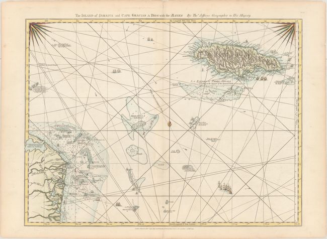
MapMaker: |
Jefferys/Sayer
|
|
| |
| |
Subject: |
Jamaica |
|
| |
Period/Size: |
1775 / 18.6" x 24.8" (47.3 x 63.0 cm)
|
|
| |
Color: |
Colored
|
|
| |
Condition: |
(A) A crisp impression on paper with a large fleur-de-lis watermark, a hint of toning along the centerfold, and a couple of minor separations along the centerfold that have been archivally repaired. There is light toning along the edges of the sheet. (condition help) |
|
| |
Source: |
The West Indian Atlas |
|
| |
References: |
Kapp (MCC-42) #102; Sellers & Van Ee #1929; Shirley (BL Atlases) M.JEF-4a #16. |
|
| |
|
|
| Sales Information |
| |
| |
Price: |
|
|
| |
| |
Offered by: |
Old World Auctions |
|
| |
Catalog: |
Auction No. 166 - Antique Maps, Charts, Atlases & Globes (9434) |
|
| |
Lot/Item #: |
345 |
|
| |
| |
Date: |
02/2018
|
|
| |
| |
|