| Item Detail |
| |
| |
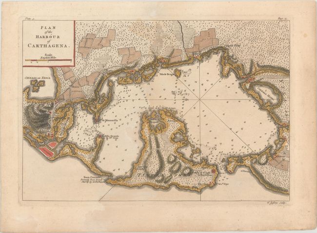
MapMaker: |
Thomas Jefferys
|
|
| |
| |
Subject: |
Cartagena, Colombia |
|
| |
Period/Size: |
1762 / 8.3" x 12.2" (21.1 x 31.0 cm)
|
|
| |
Color: |
Colored
|
|
| |
Condition: |
(B+) A nice impression with a light damp stain that covers the right half of the sheet. (condition help) |
|
| |
Source: |
A Description of the Spanish Islands on the Coast of the West Indies... |
|
| |
References: |
Kapp (MCC-77) #92c; Shirley (BL Atlases) M.JEF-3a #6. |
|
| |
|
|
| Sales Information |
| |
| |
Price: |
|
|
| |
| |
Offered by: |
Old World Auctions |
|
| |
Catalog: |
Auction No. 166 - Antique Maps, Charts, Atlases & Globes (9434) |
|
| |
Lot/Item #: |
365 |
|
| |
| |
Date: |
02/2018
|
|
| |
| |
|