Title:
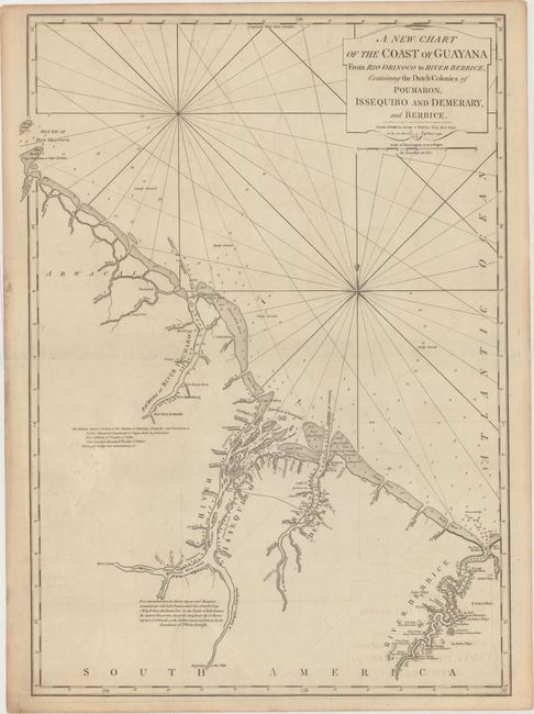
“A New Chart of the Coast of Guayana from Rio Orinoco to River Berbice, Containing the Dutch Colonies of Poumaron, Issequibo and Demerary, and Berbice”
Map Maker:
Laurie & Whittle
This detailed chart shows the coastline from the m... (full text available to subscribers)
| Item Detail |
| |
| |
MapMaker: |
Laurie & Whittle
|
|
| |
| |
Subject: |
Guyana |
|
| |
Period/Size: |
1795 / 27.2" x 19.4" (69.1 x 49.3 cm)
|
|
| |
Color: |
Black & White
|
|
| |
Condition: |
(B+) Light offsetting on a sheet with a large fleur-de-lis coat of arms, minor soiling, and a short centerfold separation at right that has been closed on verso with archival material. There is light toning along the edges of the sheet. (condition help) |
|
| |
Source: |
West India Atlas |
|
| |
References: |
|
|
| |
|
|
| Sales Information |
| |
| |
Price: |
|
|
| |
| |
Offered by: |
Old World Auctions |
|
| |
Catalog: |
Auction No. 166 - Antique Maps, Charts, Atlases & Globes (9434) |
|
| |
Lot/Item #: |
372 |
|
| |
| |
Date: |
02/2018
|
|
| |
| |
|
Antique Maps - Valuation and Pricing, Descriptions, Resources |
|
Home |
Information |
Search |
Register |
Contact Us |
Site Map
Americana Exchange, Inc. © 1999 - 2024 Americana Exchange, Inc.. All rights reserved.
OldMaps.com, the OldMaps.com logo and
AMPR are service marks or registered service marks of Americana Exchange, Inc..
|