| Item Detail |
| |
| |
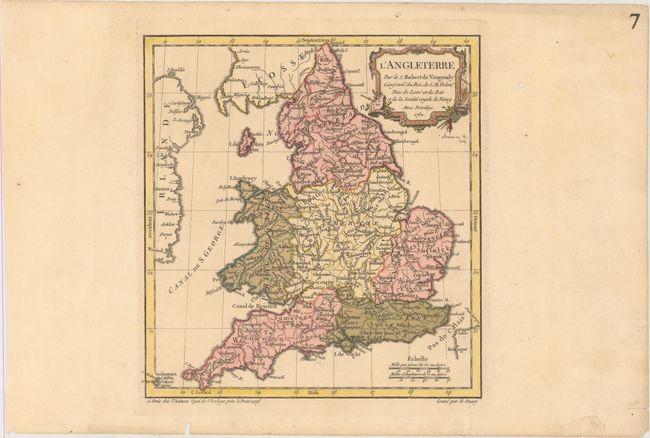
MapMaker: |
Didier Robert de Vaugondy
|
|
| |
| |
Subject: |
England & Wales |
|
| |
Period/Size: |
1762 / 9.4" x 8.9" (23.9 x 22.6 cm)
|
|
| |
Color: |
Colored
|
|
| |
Condition: |
(A) A crisp impression with original color in the map and later color in the cartouche on paper with an "IV" watermark. There are two worm holes confined to the far blank margins. (condition help) |
|
| |
Source: |
Nouvel Atlas Portatif |
|
| |
References: |
Pedley #49. |
|
| |
|
|
| Sales Information |
| |
| |
Price: |
|
|
| |
| |
Offered by: |
Old World Auctions |
|
| |
Catalog: |
Auction No. 166 - Antique Maps, Charts, Atlases & Globes (9434) |
|
| |
Lot/Item #: |
416 |
|
| |
| |
Date: |
02/2018
|
|
| |
| |
|