Title:
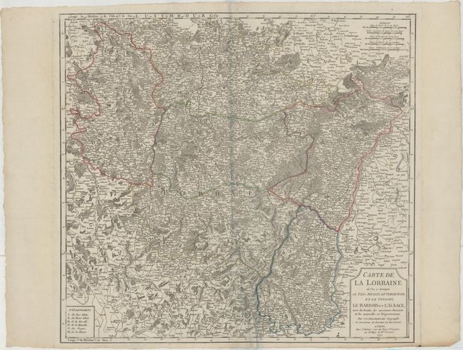
“Carte de la Lorraine ou l'on a Distingue le Pays Messin, le Verdunois et les Toulois; le Barrois et l'Alsace...”
Map Maker:
Robert de Vaugondy/Delamarche
This detailed map depicts the historical region of... (full text available to subscribers)
| Item Detail |
| |
| |
MapMaker: |
Robert de Vaugondy/Delamarche
|
|
| |
| |
Subject: |
Northeastern France |
|
| |
Period/Size: |
1792 / 19.6" x 21.0" (49.8 x 53.4 cm)
|
|
| |
Color: |
Colored
|
|
| |
Condition: |
(A) A strong impression on heavy, watermarked paper with an extraneous crease adjacent to the centerfold. (condition help) |
|
| |
Source: |
|
|
| |
References: |
|
|
| |
|
|
| Sales Information |
| |
| |
Price: |
|
|
| |
| |
Offered by: |
Old World Auctions |
|
| |
Catalog: |
Auction No. 166 - Antique Maps, Charts, Atlases & Globes (9434) |
|
| |
Lot/Item #: |
472 |
|
| |
| |
Date: |
02/2018
|
|
| |
| |
|
Antique Maps - Valuation and Pricing, Descriptions, Resources |
|
Home |
Information |
Search |
Register |
Contact Us |
Site Map
Americana Exchange, Inc. © 1999 - 2024 Americana Exchange, Inc.. All rights reserved.
OldMaps.com, the OldMaps.com logo and
AMPR are service marks or registered service marks of Americana Exchange, Inc..
|