Title:
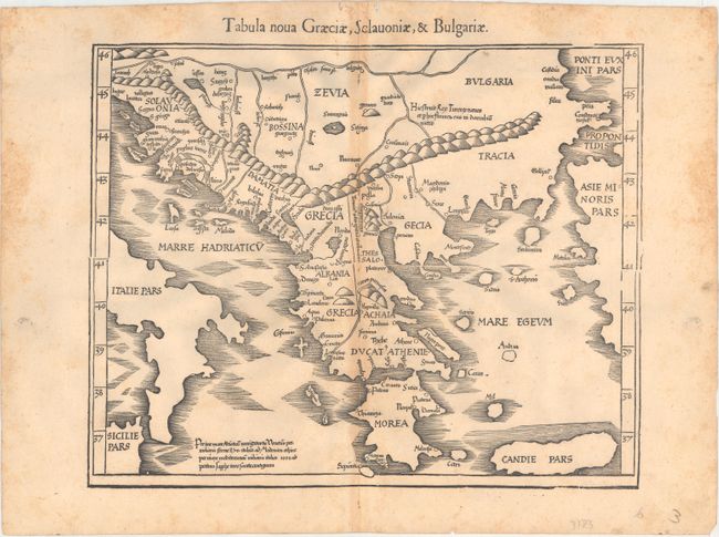
“Tabula Nova Graeciae, Sclavoniae, & Bulgariae”
Map Maker:
Ptolemy/Fries
This Ptolemaic map covers the southern portion of ... (full text available to subscribers)
| Item Detail |
| |
| |
MapMaker: |
Ptolemy/Fries
|
|
| |
| |
Subject: |
Southern Balkans |
|
| |
Period/Size: |
1541 / 12.8" x 15.9" (32.6 x 40.4 cm)
|
|
| |
Color: |
Black & White
|
|
| |
Condition: |
(B) On a watermarked sheet with separations along the centerfold that have been archivally repaired and light toning especially concentrated along the centerfold and the sheet's edges. There is light scattered foxing that is primarily confined to the she (condition help) |
|
| |
Source: |
Claudii Ptolemaei Alexandrini Geographicaeģ |
|
| |
References: |
Mickwitz & Miekkavaara #211-37. |
|
| |
|
|
| Sales Information |
| |
| |
Price: |
|
|
| |
| |
Offered by: |
Old World Auctions |
|
| |
Catalog: |
Auction No. 166 - Antique Maps, Charts, Atlases & Globes (9434) |
|
| |
Lot/Item #: |
550 |
|
| |
| |
Date: |
02/2018
|
|
| |
| |
|
Antique Maps - Valuation and Pricing, Descriptions, Resources |
|
Home |
Information |
Search |
Register |
Contact Us |
Site Map
Americana Exchange, Inc. © 1999 - 2024 Americana Exchange, Inc.. All rights reserved.
OldMaps.com, the OldMaps.com logo and
AMPR are service marks or registered service marks of Americana Exchange, Inc..
|