| Item Detail |
| |
| |
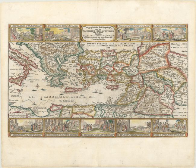
MapMaker: |
Claes Janszoon Visscher
|
|
| |
| |
Subject: |
Eastern Mediterranean & Middle East |
|
| |
Period/Size: |
1650 / 12.0" x 18.9" (30.5 x 48.0 cm)
|
|
| |
Color: |
Colored
|
|
| |
Condition: |
(A) Wide margins with professional repairs to a short centerfold separation at top, a centerfold separation that enters image less than 1" at bottom, and a hole along the centerfold in the bottom blank margin, well away from the image. (condition help) |
|
| |
Source: |
|
|
| |
References: |
cf. Laor #787; Poortman & Augusteijn #89. |
|
| |
|
|
| Sales Information |
| |
| |
Price: |
|
|
| |
| |
Offered by: |
Old World Auctions |
|
| |
Catalog: |
Auction No. 166 - Antique Maps, Charts, Atlases & Globes (9434) |
|
| |
Lot/Item #: |
623 |
|
| |
| |
Date: |
02/2018
|
|
| |
| |
|