| Item Detail |
| |
| |
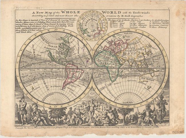
MapMaker: |
Herman Moll
|
|
| |
| |
Subject: |
World |
|
| |
Period/Size: |
1732 / 7.9" x 10.4" (20.1 x 26.5 cm)
|
|
| |
Color: |
Colored
|
|
| |
Condition: |
(B+) Light soiling with minor edge chips and short tears confined to the bottom blank margin, which has been reinforced on verso with tissue. There are two, tiny extraneous purple ink marks at the center of the map image. (condition help) |
|
| |
Source: |
Atlas Minor |
|
| |
References: |
Shirley (BL Atlases) T.MOLL-9b #1; Phillips (Atlases) #585-1. |
|
| |
|
|
| Sales Information |
| |
| |
Price: |
|
|
| |
| |
Offered by: |
Old World Auctions |
|
| |
Catalog: |
Auction No. 166 - Antique Maps, Charts, Atlases & Globes (9434) |
|
| |
Lot/Item #: |
25 |
|
| |
| |
Date: |
02/2018
|
|
| |
| |
|