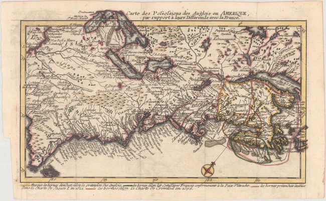
Title:
“Carte des Possessions des Anglois en Amerique, par Rapport a Leurs Differends avec la France”
Map Maker:
Jean Conrad Back
This rare and highly unusual map depicts the east ... (full text available to subscribers)
| Item Detail |
| |
| |
MapMaker: |
Jean Conrad Back
|
|
| |
| |
Subject: |
Colonial Eastern United States & Canada |
|
| |
Period/Size: |
1759 / 7.1" x 11.9" (18.1 x 30.3 cm)
|
|
| |
Color: |
Colored
|
|
| |
Condition: |
(B+) Issued folding on a watermarked sheet with faint offsetting. (condition help) |
|
| |
Source: |
Le Point d'Appui entre la Hollande et l'Angleterre… |
|
| |
References: |
|
|
| |
|
|
| Sales Information |
| |
| |
Price: |
|
|
| |
| |
Offered by: |
Old World Auctions |
|
| |
Catalog: |
Auction No. 167 - Antique Maps, Charts, Atlases & Globes (9435) |
|
| |
Lot/Item #: |
73 |
|
| |
| |
Date: |
03/2018
|
|
| |
| |
|
Antique Maps - Valuation and Pricing, Descriptions, Resources |
|
Home |
Information |
Search |
Register |
Contact Us |
Site Map
Americana Exchange, Inc. © 1999 - 2024 Americana Exchange, Inc.. All rights reserved.
OldMaps.com, the OldMaps.com logo and
AMPR are service marks or registered service marks of Americana Exchange, Inc..
|