| Item Detail |
| |
| |
MapMaker: |
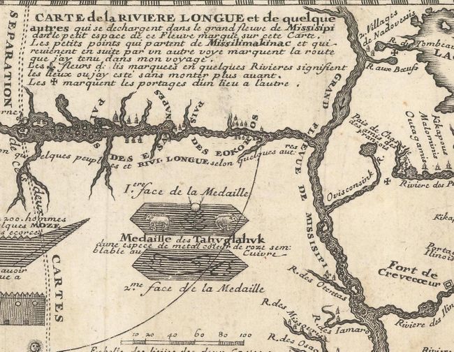
Louis Armand de Lom d'Arce, de Lahontan
|
|
| |
| |
Subject: |
Colonial Upper Midwestern United States, River Longue |
|
| |
Period/Size: |
1703 / 4.8" x 11.8" (12.2 x 30.0 cm)
|
|
| |
Color: |
Black & White
|
|
| |
Condition: |
(B+) Issued folding, now flattened, on paper with a large coat of arms watermark. There is light soiling, and the map has been remargined at left to accommodate framing. (condition help) |
|
| |
Source: |
Nouveaux Voyages de M. le Baron de Lahontan dans l'Amerique Septentrionale |
|
| |
References: |
Kershaw #299. |
|
| |
|
|
| Sales Information |
| |
| |
Price: |
|
|
| |
| |
Offered by: |
Old World Auctions |
|
| |
Catalog: |
Auction No. 167 - Antique Maps, Charts, Atlases & Globes (9435) |
|
| |
Lot/Item #: |
119 |
|
| |
| |
Date: |
03/2018
|
|
| |
| |
|