Title:
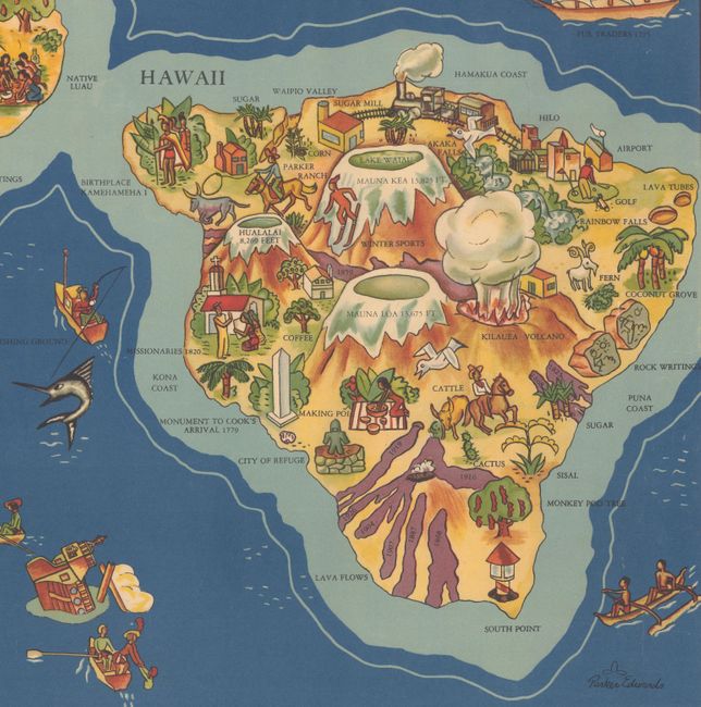
“The Dole Map of the Hawaiian Islands U.S.A. Being a Descriptive Portrayal of the History, Transportation, Industries and Geography of the Territory of Hawaii, U.S.A.”
Map Maker:
Infrequent Publ. - Advertising
This vivid and graphic map of the Hawaiian islands... (full text available to subscribers)
| Item Detail |
| |
| |
MapMaker: |
Infrequent Publ. - Advertising
|
|
| |
| |
Subject: |
Hawaii |
|
| |
Period/Size: |
1937 / 17.4" x 35.4" (44.2 x 90.0 cm)
|
|
| |
Color: |
Colored
|
|
| |
Condition: |
(B) A colorful example with a small area of loss in the world map (just below the Arctic Circle) and another area of loss in the ocean to the south of Kauai. There are some faint extraneous creases in the image and a small abrasion in the top blank margi (condition help) |
|
| |
Source: |
|
|
| |
References: |
|
|
| |
|
|
| Sales Information |
| |
| |
Price: |
|
|
| |
| |
Offered by: |
Old World Auctions |
|
| |
Catalog: |
Auction No. 167 - Antique Maps, Charts, Atlases & Globes (9435) |
|
| |
Lot/Item #: |
151 |
|
| |
| |
Date: |
03/2018
|
|
| |
| |
|
Antique Maps - Valuation and Pricing, Descriptions, Resources |
|
Home |
Information |
Search |
Register |
Contact Us |
Site Map
Americana Exchange, Inc. © 1999 - 2024 Americana Exchange, Inc.. All rights reserved.
OldMaps.com, the OldMaps.com logo and
AMPR are service marks or registered service marks of Americana Exchange, Inc..
|