Title:
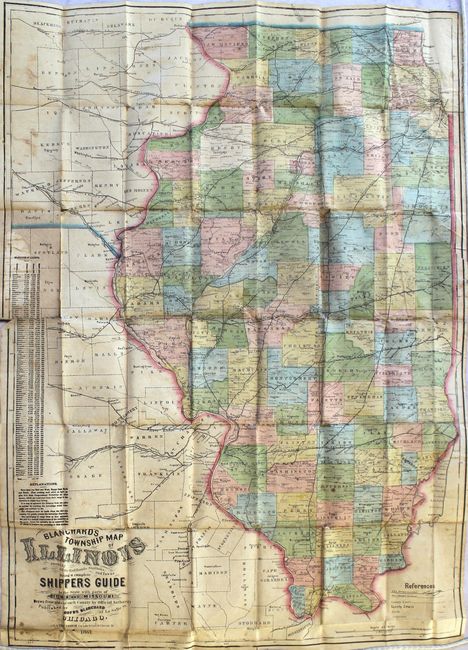
“Blanchard's Township Map of Illinois Showing All the Rail Roads, Stations, and Towns Being a Complete Shippers Guide to the State with Parts of Iowa and Missouri...”
Map Maker:
Rufus Blanchard
This is a very scarce, pre-fire Chicago map publis... (full text available to subscribers)
| Item Detail |
| |
| |
MapMaker: |
Rufus Blanchard
|
|
| |
| |
Subject: |
Illinois |
|
| |
Period/Size: |
1867 / 31.8" x 23.3" (80.8 x 59.2 cm)
|
|
| |
Color: |
Colored
|
|
| |
Condition: |
(B) Issued folding with light toning, scattered foxing, and staining. There are a number of fold separations primarily along one horizontal fold that have been mostly closed on verso with archival tape, and a few splits at fold intersections resulting in (condition help) |
|
| |
Source: |
|
|
| |
References: |
cf. Rumsey #4513. |
|
| |
|
|
| Sales Information |
| |
| |
Price: |
|
|
| |
| |
Offered by: |
Old World Auctions |
|
| |
Catalog: |
Auction No. 167 - Antique Maps, Charts, Atlases & Globes (9435) |
|
| |
Lot/Item #: |
152 |
|
| |
| |
Date: |
03/2018
|
|
| |
| |
|
Antique Maps - Valuation and Pricing, Descriptions, Resources |
|
Home |
Information |
Search |
Register |
Contact Us |
Site Map
Americana Exchange, Inc. © 1999 - 2024 Americana Exchange, Inc.. All rights reserved.
OldMaps.com, the OldMaps.com logo and
AMPR are service marks or registered service marks of Americana Exchange, Inc..
|