| Item Detail |
| |
| |
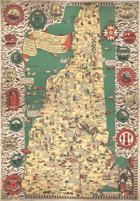
MapMaker: |
Shurtleff & McMillin
|
|
| |
| |
Subject: |
New Hampshire |
|
| |
Period/Size: |
1926 / 33.3" x 23.0" (84.6 x 58.5 cm)
|
|
| |
Color: |
Colored
|
|
| |
Condition: |
(B+) Issued folding and now flattened and backed with tissue to reinforce and repair a few minor fold separations and edge tears. Light soiling at top and bottom. (condition help) |
|
| |
Source: |
|
|
| |
References: |
Hornsby (Picturing America) pp. 22, 48. |
|
| |
|
|
| Sales Information |
| |
| |
Price: |
|
|
| |
| |
Offered by: |
Old World Auctions |
|
| |
Catalog: |
Auction No. 167 - Antique Maps, Charts, Atlases & Globes (9435) |
|
| |
Lot/Item #: |
167 |
|
| |
| |
Date: |
03/2018
|
|
| |
| |
|