Title:
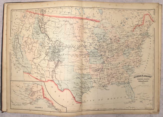
“Asher & Adams' New Commercial, Topographical, and Statistical Atlas and Gazetteer of the United States: with Maps Showing the Dominion of Canada, Europe and the World”
Map Maker:
Asher & Adams
This large-format atlas of the United States is co... (full text available to subscribers)
| Item Detail |
| |
| |
MapMaker: |
Asher & Adams
|
|
| |
| |
Subject: |
Atlases, United States |
|
| |
Period/Size: |
1872 / 17.8" x 13.1" (45.3 x 33.3 cm)
|
|
| |
Color: |
Colored
|
|
| |
Condition: |
(B+) The maps are very good with light toning and soiling and short edge tears on a couple of maps. The text is bright with light toning only along the edges and an occasional spot of foxing or soiling. The pastedown and endpapers in front and back are (condition help) |
|
| |
Source: |
|
|
| |
References: |
Phillips (Atlases) #1270. |
|
| |
|
|
| Sales Information |
| |
| |
Price: |
|
|
| |
| |
Offered by: |
Old World Auctions |
|
| |
Catalog: |
Auction No. 167 - Antique Maps, Charts, Atlases & Globes (9435) |
|
| |
Lot/Item #: |
439 |
|
| |
| |
Date: |
03/2018
|
|
| |
| |
|
Antique Maps - Valuation and Pricing, Descriptions, Resources |
|
Home |
Information |
Search |
Register |
Contact Us |
Site Map
Americana Exchange, Inc. © 1999 - 2024 Americana Exchange, Inc.. All rights reserved.
OldMaps.com, the OldMaps.com logo and
AMPR are service marks or registered service marks of Americana Exchange, Inc..
|