| Item Detail |
| |
| |
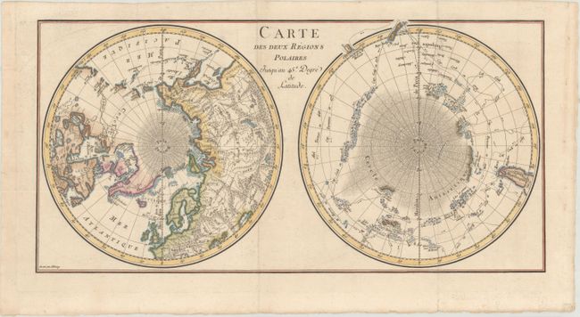
MapMaker: |
George Louis le Clerc, Comte de Buffon
|
|
| |
| |
Subject: |
Polar |
|
| |
Period/Size: |
1778 / 8.7" x 17.5" (22.1 x 44.5 cm)
|
|
| |
Color: |
Colored
|
|
| |
Condition: |
(A) A nice impression, issued folding on watermarked paper with a hint of offsetting and light marginal soiling. (condition help) |
|
| |
Source: |
Histoire Naturelle Generale et Particuliere |
|
| |
References: |
|
|
| |
|
|
| Sales Information |
| |
| |
Price: |
|
|
| |
| |
Offered by: |
Old World Auctions |
|
| |
Catalog: |
Auction No. 168 - Antique Maps, Charts, Atlases & Globes (9436) |
|
| |
Lot/Item #: |
39 |
|
| |
| |
Date: |
06/2018
|
|
| |
| |
|