| Item Detail |
| |
| |
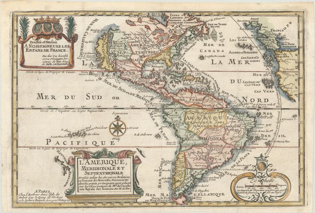
MapMaker: |
Nicolas de Fer
|
|
| |
| |
Subject: |
Western Hemisphere - America |
|
| |
Period/Size: |
1717 / 8.8" x 13.1" (22.4 x 33.3 cm)
|
|
| |
Color: |
Colored
|
|
| |
Condition: |
(A) A crisp impression on watermarked paper, issued folding and now flattened with a printer's crease at bottom left. There is a binding trim at left that has been professionally replaced with an adjacent 1/2" binding tear that has been professionally re (condition help) |
|
| |
Source: |
L'Atlas Curieux ou le Monde... |
|
| |
References: |
Burden #759; McLaughlin #135, Pastoureau, FER I D; Tooley (Amer) #61, p. 126. |
|
| |
|
|
| Sales Information |
| |
| |
Price: |
|
|
| |
| |
Offered by: |
Old World Auctions |
|
| |
Catalog: |
Auction No. 168 - Antique Maps, Charts, Atlases & Globes (9436) |
|
| |
Lot/Item #: |
72 |
|
| |
| |
Date: |
06/2018
|
|
| |
| |
|